GIS Mapping :-
I am text block. Click edit button to change this text. Lorem ipsum dolor sit amet, consectetur adipiscing elit. Ut elit tellus, luctus nec ullamcorper mattis, pulvinar dapibus leo.I am text block. Click edit button to change this text. Lorem ipsum dolor sit amet, consectetur adipiscing elit. Ut elit tellus, luctus nec ullamcorper mattis, pulvinar dapibus leo.I am text block. Click edit button to change this text. Lorem ipsum dolor sit amet, consectetur adipiscing elit. Ut elit tellus, luctus nec ullamcorper mattis, pulvinar dapibus leo.
Photogrammetry & UAV Mapping:
We partner with some of the well know Engineering, Construction, Urban Development, Mining and land surveying companies to provide our photogrammetric and UVA mapping services.
Biz-Web Technologies has the equipment and software necessary to offer a wide variety of photogrammetric services and to complete your project. Using our extensive experience, we maintain careful control over the processes, assure product accuracy, and keep costs down.
Biz-Web’s staff of experienced technicians have the industry expertise necessary to deliver superior products and services to your organization that are completed on time and under budget. Our project expertise ranges from creating basic planimetric features to complex 3D city models.
Biz-Web Technologies sticks to the high quality deliverables to reach the customer satisfaction level in all aspects by adopting stringent procedures under the surveillance of expert’s team. The data processes under various levels of quality systems such as online quality checks (at production stage), exclusive quality checks (after production), and pre-delivery check.
Biz-Web’s digital photogrammetry services includes Aerial triangulation, Texturing, DEM / DTM generation, stereo compilation, topographic and Planimetric feature extraction(2D and 3D), ortho generation and true ortho generation, color balancing, mosaicking and tile generation, contour generation and 3D terrain visualization.
Lidar :-
Biz-Web Technologies provides LiDAR (Light Detection and Ranging) data processing services for various industries such as transportation, power (electric transmission line), land use planning, agriculture and forestry. Acknowledgement of LiDAR for topographical mapping, contour generation and highly accurate models and data analysis is higher than ever worldwide.
Biz-Web offers skilled LiDAR, extracting accurate height models in the form of Digital Terrain Models (DTM) and Digital Elevation Models (DSM). Our LiDAR services are useful in Cut and Fill calculations for engineering projects like dams, tunnels and roads modeling systems like oil and gas pipelines for maintenance and status evaluation.
Offering our LiDAR data processing services to some of the leading data collection companies from India, Europe to US and Canada.
LiDAR outsourcing services of Biz-Web Technology offers you high quality outputs and helps you leverage your operational efficiency.
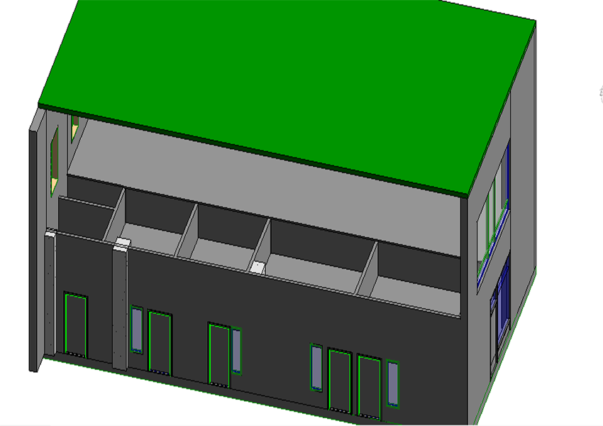
BIM :-
Building Information Modeling is a capable technology which facilitates to create one of the most accurate virtual construction, engineering, architectural models. A powerful tool to ever more efficiently plan, design, construct and manager infrastructure or buildings.
Biz-Web Technologies with a humble beginning, today, is one of the well known BIM service providers in India. We serve clients from US, Europe, Middle East and Canada.
Services
Structural BIM Modeling
Architectural BIM Modeling
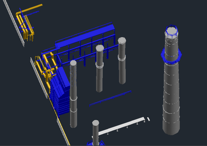
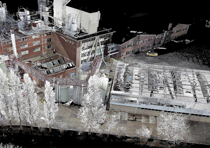
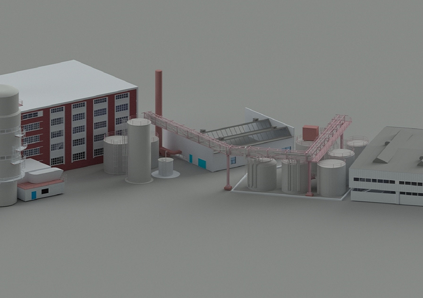
Scan to BIM Modeling
Remote Sensing :-
This process is usually applied to Earth surface changes at two or more times. It is useful in many applications such as land use changes, habitat fragmentation, rate of deforestation, coastal change, urban sprawl and other cumulative changes. Biz-Web Technologies uses remote sensing and image processing technology to help manage and access impact on agriculture, forest, rivers & other water resources, land development in ever increasing stress of global warming. Population increase is also one of the major cause of burden on natural resources which results in this drastic change.